City of El Paso Annexation Map
Mapa de anexión de la Ciudad de El Paso
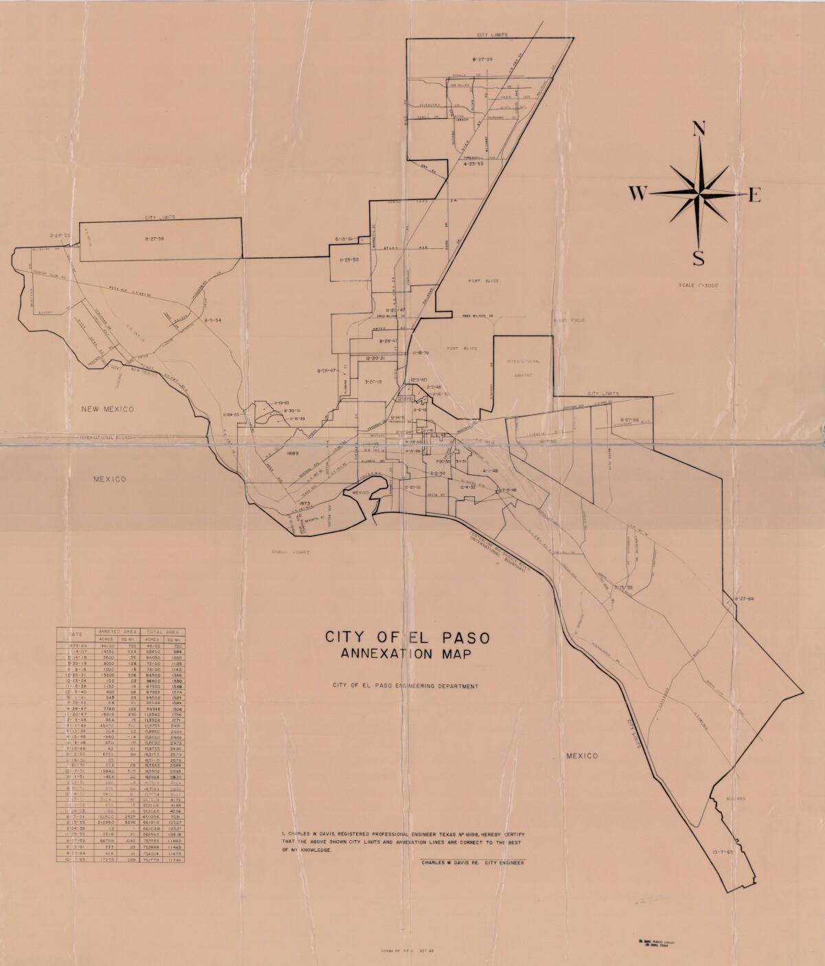
Mapa de anexión de la Ciudad de El Paso

Incluye fechas de anexión y medida de acres anexados entre los años 1873-1965

Área: Central / Downtown

Fuente: City of El Paso Engineering Department; Charles W. Davis, City Engineer

Cargado por: Border Heritage Center

Comentarios

Hacer un comentario
Gracias por su comentario

Reportar esta entrada

Elige la razón más importante para este reporte

Tu nombre

Tu correo electrónico

Detalle opcional

Gracias por su reporte

Más sobre la misma comunidad-colección

Alternative Band Poster 2000s

Alternative music show at E9 on 511 Western Street.

Alternative Band Poster 2000s

Alternative music poster for show at the T-Lounge on 1218 Texas ...

Alternative Band Poster 2000s

Record release poster for alternative music in the 2000s.

The Dream Monster

Artist MJAYM working on his cartoon character The Dream Monster ...

home.search_collection