Map of Texas and Adjacent Regions in the Eighteenth Century
Mapa de Texas y regiones adyacentes en el siglo dieciocho
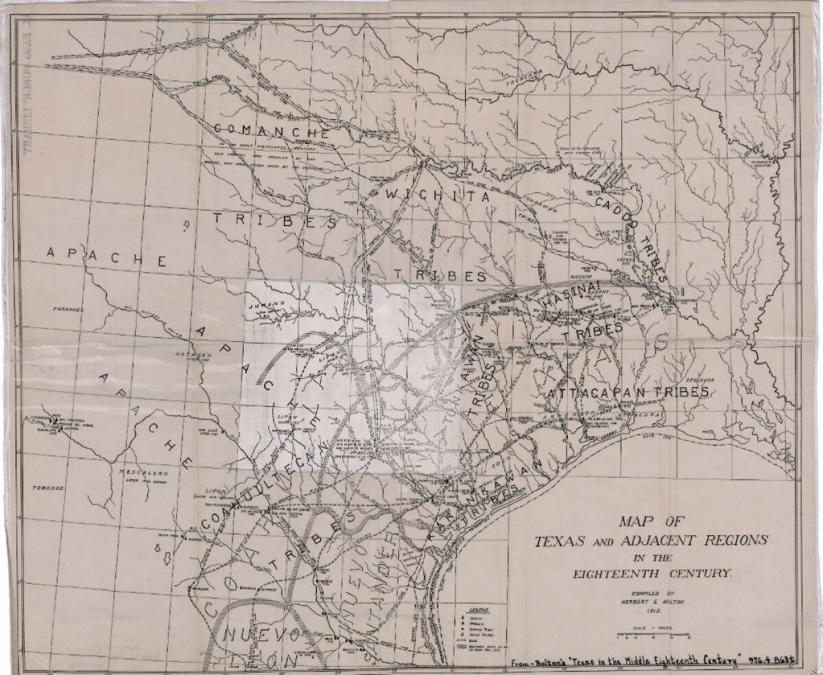
Map of Texas and Adjacent Regions in the Eighteenth Century
Map of Texas and the adjacent regions illustrating missions, presidios, Spanish towns, Indian villages, rivers, roads and boundary lines. Indian tribe names are shown in their areas of concentration.
Report this entry
More from the same community-collection
Texas Western Team at the White House 2006
White House Celebration for the Texas Western 1966 Champions.
Me throwing the first pitch at a Chihuahuas game
I was selected to throw the first pitch in a Chihuahuas game. ...
Rick Kern's Vocal Show Band - Tapestry, with Guy Lombardo.
This picture was taken in Springfield, Ohio right after one of ...

