Map No. 1 from Fort Smith to the Rio Grande
Mapa numero 1º desde Fort Smith hasta el Río Grande.
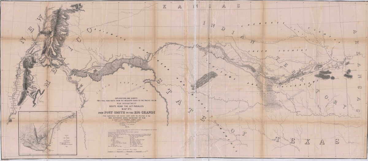
Map No. 1 from Fort Smith to the Rio Grande
Map of the route near the 35th parallel. Part of the explorations and surveys for a railroad route from the Mississippi River to the Pacific ocean. Compiled from the explorations and surveys made under the direction of the Secretary of War. Map has topographical features: mountains, sierras, rivers, and creeks. Prairie and timber areas are indicated. Indian tribe concentrations, forts, wagon trail lines, and some cities are shown.
Report this entry
More from the same community-collection
Texas Western Team at the White House 2006
White House Celebration for the Texas Western 1966 Champions.
Rick Kern's Vocal Show Band - Tapestry, with Guy Lombardo.
This picture was taken in Springfield, Ohio right after one of ...

