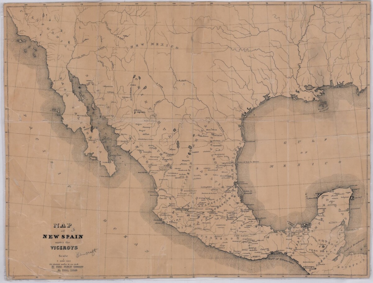
Map of New Spain under the Viceroys
Mapa de Nueva España bajo los virreyes

Map of New Spain under the Viceroys
This map illustrates 1600's New Spain. Areas from New Mexico, California, Baja California to Durango, Guanajuato, Puebla and through to Honduras are shown. City/town names, and rivers are indicated. Image Description: A brown borderless map of what was New Spain from New Mexico through Honduras. The map shows rivers and states, the Gulf of Mexico and parts of the Pacific Ocean.
Report this entry
More from the same community-collection
Wedding Photograph - Jesus & Angela Hermosillo - 1941
Wedding Photograph - Jesus & Angela Hermosillo - 1941 - City of ...
David T Howard High School Graduation Class 1963
David T Howard High School Graduation Class 1963 with Walt ...
Brothers Playing Music Together - 1957
Brothers playing music together - the year was 1957. This was ...
Jose Gabriel Chinea and Crystal M. Chinea - 2014
Jose Gabriel Chinea and Crystal M. Chinea - 2014 - Ft Worth ...


