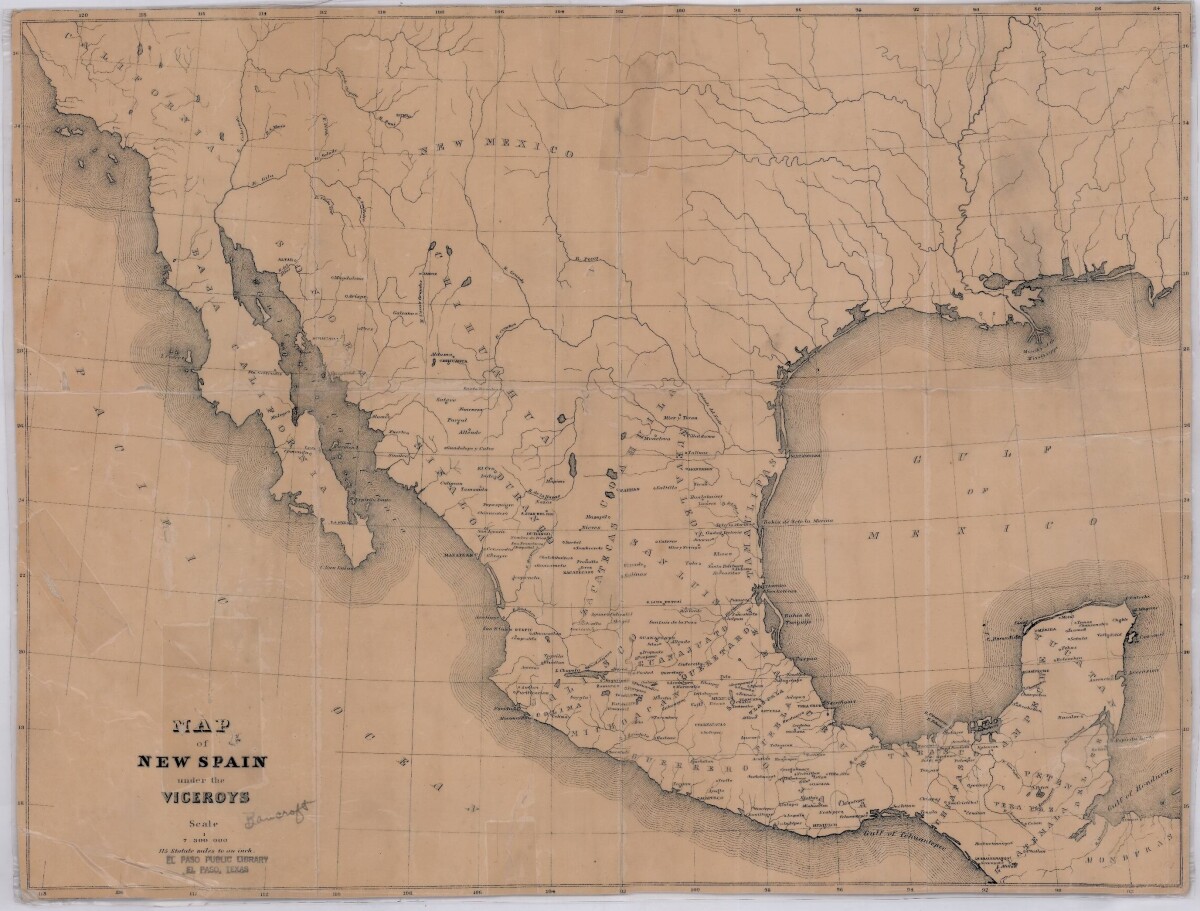
Map of New Spain under the Viceroys
Mapa de Nueva España bajo los virreyes

Map of New Spain under the Viceroys
This map illustrates 1600's New Spain. Areas from New Mexico, California, Baja California to Durango, Guanajuato, Puebla and through to Honduras are shown. City/town names, and rivers are indicated. Image Description: A brown borderless map of what was New Spain from New Mexico through Honduras. The map shows rivers and states, the Gulf of Mexico and parts of the Pacific Ocean.
Report this entry
More from the same community-collection
Harrier Jet, vertical take off landing
Originally developed by the British Air Force later adopted by ...
Loretto Class of 65 40th Reunion
In Juarez Loretto class of 65 celebrating 40th reunion. Sitting ...
LaQuintus Dowell vs. NM State 9/19/15
UTEP's LaQuintus Dowell scores a touchdown at NM State on Sept. ...
LaQuintus Dowell & Sean Kugler vs. NM State 9/19/15
UTEP Coach Sean Kugler congratulates LaQuintus Dowell after he ...
Darrin Laufasa vs. NM State 9/19/15
UTEP's Darrin Laufasa goes airborne in a game at NM State on ...
Cedrick Lang vs. NM State 9/19/15
UTEP's Cedrick Lang scores the winning touchdown at NM State on ...


