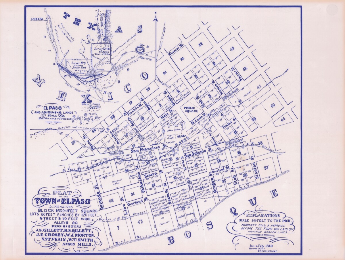
Plat of the Town of El Paso
Plano del Pueblo de El Paso

Plat of the Town of El Paso
Plat map of the Town of El Paso (Texas); includes dimensions for lots, streets, alleys; an inset with topographical representations; Scale of adjoining lands is 1000 to the inch; Explanations scale is 200 feet to the inch; Survey details and Acequia (canal) lines shown.
Report this entry
More from the same community-collection
Installation view, Early West Texas, EPMA.
Early West Texas: Waypoint and Home July 1 – November 3, 2018 ...
Installation view, Early West Texas, EPMA.
Early West Texas: Waypoint and Home July 1 – November 3, 2018 ...
Installation view, Early West Texas, EPMA.
Early West Texas: Waypoint and Home July 1 – November 3, 2018 ...
Installation view, The Empire of Texas, EPMA.
The Empire of Texas March 2 – June 24, 2018 Peter and ...
Installation view, The Empire of Texas, EPMA.
The Empire of Texas March 2 – June 24, 2018 Peter and ...
Installation view, The Empire of Texas, EPMA.
The Empire of Texas March 2 – June 24, 2018 Peter and ...
Installation view, The Empire of Texas, EPMA.
The Empire of Texas March 2 – June 24, 2018 Peter and ...
Installation view, Papel Chicano Dos, EPMA.
Papel Chicano Dos: Works on Paper from the Collection of Cheech ...


