City of El Paso Annexation Map
Mapa de anexión de la Ciudad de El Paso
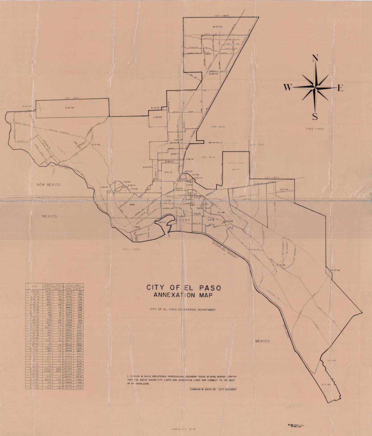
City of El Paso Annexation Map
Annexation map of the City of El Paso, Texas. Includes a chart showing the annexation date, the annexed area acreage and square miles; and the total area acreage and square miles.
Report this entry
More from the same community-collection
Sign of El Paso County Courthouse
The image shows the sign of the new El Paso County Courthouse. ...
El Paso Museum of History -El Paso, Texas
El Paso Museum of History located at Cleveland Square Park - El ...
Mariachi Band at El Paso Museum of History
Mariachi Band playing good music at the El paso Museum of ...
Fashion Show - El Paso Museum of History
Fashion show at the El Paso Museum of History--downtown El Paso, ...
Santa Fe Bridge 1911 - El Paso, Texas
The picture shows Santa Fe Street bridge, which connected El ...

