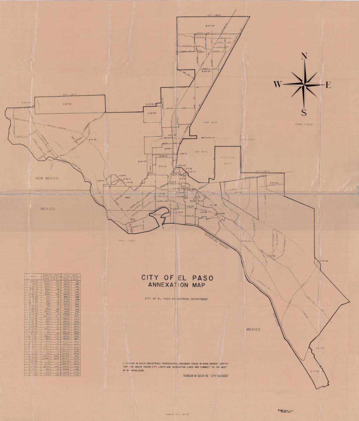
City of El Paso Annexation Map
Mapa de anexión de la Ciudad de El Paso

City of El Paso Annexation Map
Annexation map of the City of El Paso, Texas. Includes a chart showing the annexation date, the annexed area acreage and square miles; and the total area acreage and square miles.
Report this entry
More from the same community-collection
Photography by Heber A. Nickolath
Pasos Urbanos: A Photographic Narrative of Downtown Borderland ...
Photography by Heber A. Nickolath
Pasos Urbanos: A Photographic Narrative of Downtown Borderland ...
Photography by Heber A. Nickolath
Pasos Urbanos: A Photographic Narrative of Downtown Borderland ...
Photography by Heber A. Nickolath
Pasos Urbanos: A Photographic Narrative of Downtown Borderland ...
Photography by Heber A. Nickolath
Pasos Urbanos: A Photographic Narrative of Downtown Borderland ...
Photography by Ronald Henry Wells
Pasos Urbanos: A Photographic Narrative of Downtown Borderland ...
Photography by Ronald Henry Wells
Pasos Urbanos: A Photographic Narrative of Downtown Borderland ...
Photography by Ronald Henry Wells
Pasos Urbanos: A Photographic Narrative of Downtown Borderland ...
Photography by Ronald Henry Wells
Pasos Urbanos: A Photographic Narrative of Downtown Borderland ...
Photography by Ronald Henry Wells
Pasos Urbanos: A Photographic Narrative of Downtown Borderland ...
Photography by Omar Zuniga Renteria
Pasos Urbanos: A Photographic Narrative of Downtown Borderland ...
Photography by Rigoberto R De La Mora
Pasos Urbanos: A Photographic Narrative of Downtown Borderland ...
Photography by Rigoberto R De La Mora
Pasos Urbanos: A Photographic Narrative of Downtown Borderland ...
Photography by Rigoberto R De La Mora
Pasos Urbanos: A Photographic Narrative of Downtown Borderland ...


