Map and Street Guide of El Paso, Texas circa 1925
Mapa y guía callejera de El Paso Texas
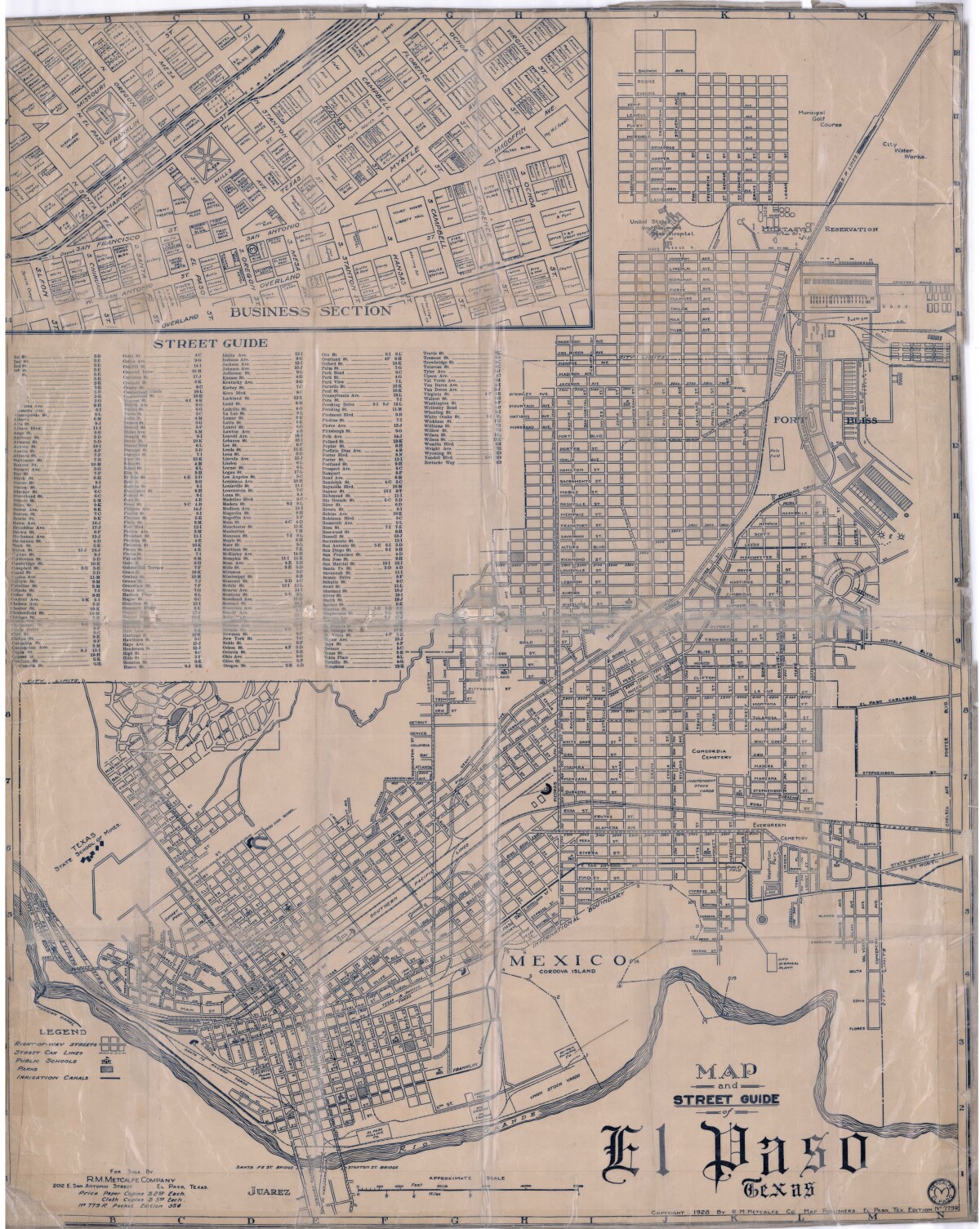
Map and Street Guide of El Paso, Texas circa 1925
Map and street guide of El Paso, Texas. The map includes right-of-way streets, street car lines, public schools, parks and irrigation canals. An inset of the city's business section is shown above the street guide. Highlighted are the Texas State School of Mines; the Santa Fe St. and Stanton St. bridges into Juarez, Mexico; Cordova Island, Mexico; and the area of Ft. Bliss Military Reservation.
Report this entry
More from the same community-collection
Commissioners Court Resolution February 1, 2016
Commissioners Court Resolution Celebrating the 50th anniversary ...
50th Anniversary Celebration of the 1966 Texas Western Team
Celebrating the Texas Western 1966 Basketball Champions with, ...
Jennifer Han - Weigh In At Southwest University Park - 2016
Tom McKay, Jennifer Han and Everett Thomas at weigh-in for ...
Jennifer Han - Weigh In At Southwest University Park - 2016
Jennifer Han will face Calixta Silgado of Colombia after her ...
Jennifer Han and David Ochoa - 2016
Jennifer Han and David Ochoa at weigh in at Southwest University ...
Jennifer Han - Weigh In At Southwest University Park - 2016
Jennifer Han - Weigh In At Southwest University Park - 2016 ...
Jennifer Han - Weigh In At Southwest University Park - 2016
Jennifer Han will face Calixta Silgado of Colombia after her ...
Stephanie Han - Weigh In At Southwest University Park - 2016
Stephanie Han - sister of Jennifer Han at Jennifer's weigh in at ...
Jennifer Han Defends Her IBF Featherweight Title - 2016
Jennifer Han defeated Calista Silgado to retain her IBF ...


