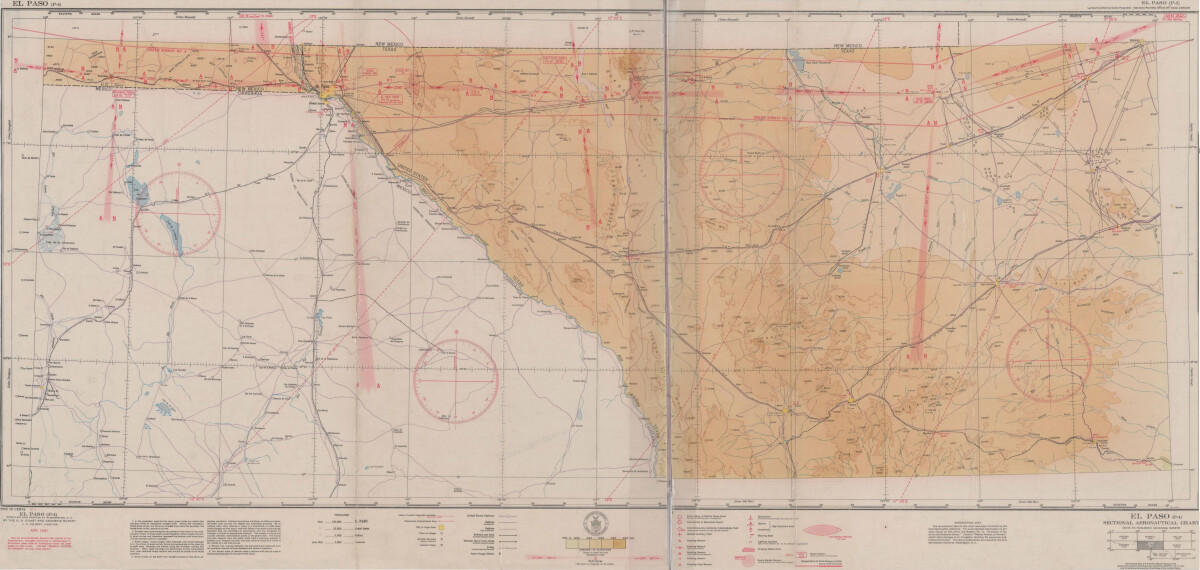
El Paso (P-4) Sectional Aeronautical Chart
Tabla Aeronáutica Seccional El Paso (P-4)

El Paso (P-4) Sectional Aeronautical Chart
Published in April, 1941, this aeronautical map indicates the "shortest and most direct courses between points in question". Population statistics for El Paso, Midland, Sanderson, Texas; and Ciudad Juarez, Mexico are provided. The legend includes symbols for army, navy and marine corps fields; commercial and municipal airports; lighting facilities and airspace reservations.
Report this entry
More from the same community-collection
Harrier Jet, vertical take off landing
Originally developed by the British Air Force later adopted by ...
Loretto Class of 65 40th Reunion
In Juarez Loretto class of 65 celebrating 40th reunion. Sitting ...
LaQuintus Dowell vs. NM State 9/19/15
UTEP's LaQuintus Dowell scores a touchdown at NM State on Sept. ...
LaQuintus Dowell & Sean Kugler vs. NM State 9/19/15
UTEP Coach Sean Kugler congratulates LaQuintus Dowell after he ...
Darrin Laufasa vs. NM State 9/19/15
UTEP's Darrin Laufasa goes airborne in a game at NM State on ...
Cedrick Lang vs. NM State 9/19/15
UTEP's Cedrick Lang scores the winning touchdown at NM State on ...


