Pictorial Map of El Paso, Texas and Juarez, Mexico
Mapa pictórico de El Paso, Texas y de Juarez, México
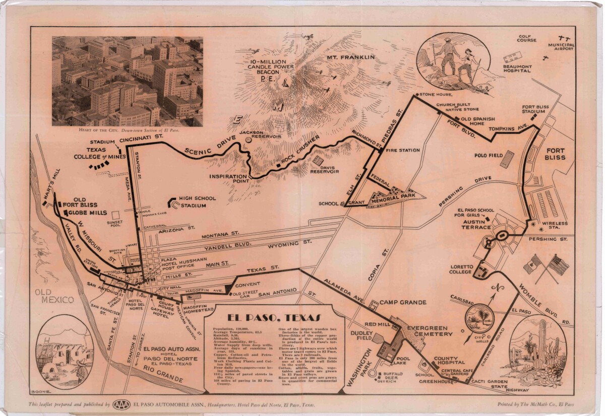
Pictorial Map of El Paso, Texas and Juarez, Mexico

Visitor guide with pictorial map of El Paso, Texas and international cross streets into Juarez, Mexico. Location of places of interest in Juarez, Mexico are noted. Reverse side shows main avenues, streets, historical landmarks, train station, parks, military fort, municipal buildings and colleges. Also notes population statistics; infra-structural, weather and agricultural details.

Area: Central / Downtown

Source: AAA El Paso Automobile Assn.

Uploaded by: Border Heritage Center

Comments

Add a comment
Thank you for your comment

Report this entry

Choose the most important reason for this report

Your name

Your email address

Optional detail

Thank you for your report

More from the same community-collection

The Dream Monster

Artist MJAYM working on his cartoon character The Dream Monster ...

Bordalo Mural Install

Educational and conservationist nonprofit Green Hope Project, ...

Bordalo Mural Install

Bordalo Mural Installation funded by the Green Hope Project

Rubin Center IMLS Speaker Series featuring Carolina Villarroel

IMLS Speaker Series featuring Carolina Villarroel hosted by the ...

Mexican American Cultural Center

For El Paso’s brand new Mexican American Cultural Center, ...

Zork Wedding Dresses

The white velvet wedding dress was worn by Ruth Schwartz Zork at ...

home.search_collection