IBWCVI
IBWCVI
IBWCVI
IBWCVI
IBWCVI
IBWCVI
IBWCVI
IBWCVI
IBWCVI
IBWCVI
IBWCVI
IBWCVI
IBWCVI
IBWCVI
IBWCVI
IBWCVI
IBWCVI
IBWCVI
IBWCVI
IBWCVI
American Dam
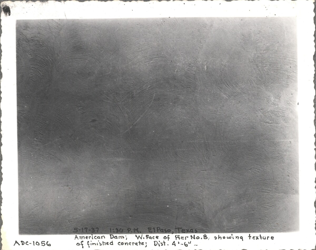
May 17, 1937 1:30 PM El Paso TX. American Dam, west face of pier No. 8 showing texture of finished concrete at distance of 4'- 6'
Area: Central / Smeltertown
Source: IBWC
Uploaded by: El Paso Museum of History
American Dam
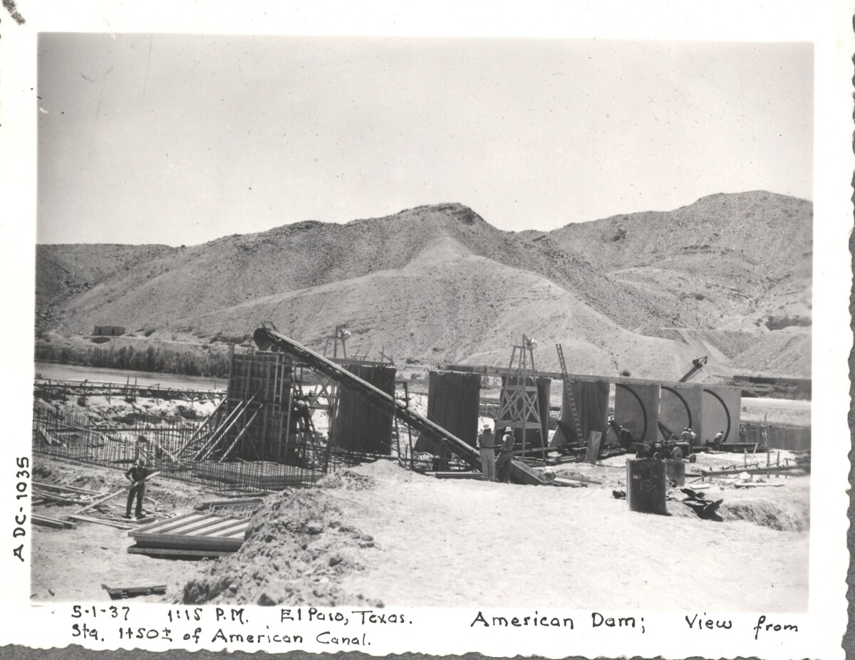
May 1, 1937 1:15PM El Paso TX. American Dam, view from STA. 1450 of American Canal.
Area: Central / Smeltertown
Source: IBWC
Uploaded by: El Paso Museum of History
American Dam
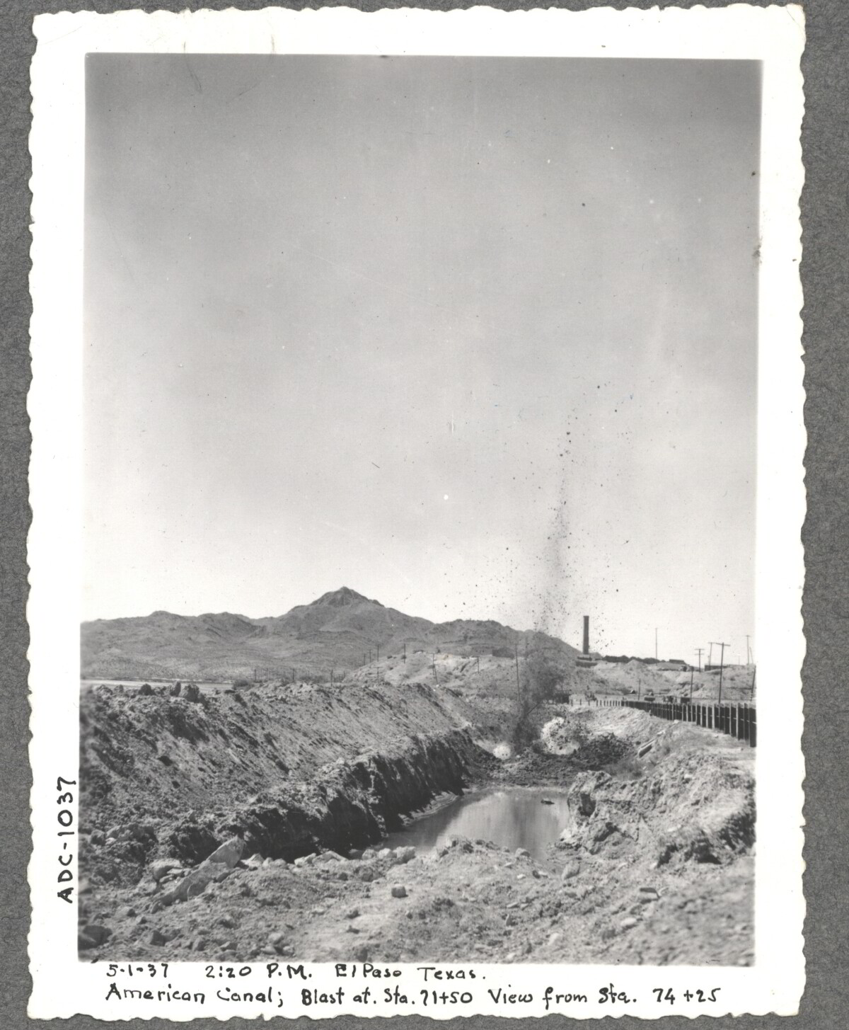
May 1, 1937 2:20 PM El Paso TX. American Dam, blast at Sta. 1450 view from Sta. 74 & 25
Area: Central / Smeltertown
Source: IBWC
Uploaded by: El Paso Museum of History
American Dam
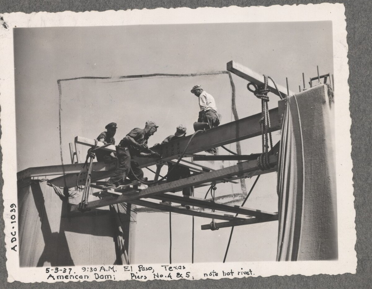
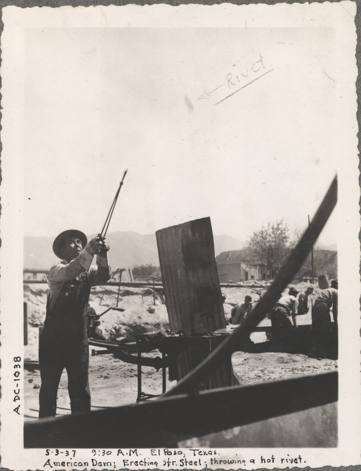
May 3, 1937 9:30 AM El Paso TX. American Dam, pier No. 4&5 erecting steel structure, notice hot rivet in steel frame.
Area: Central / Smeltertown
Source: IBWC
Uploaded by: El Paso Museum of History
American Dam
May 3, 1937 9:30 AM El Paso TX. American Dam, erecting steel structure, throwing hot rivet.
Area: Central / Smeltertown
Source: IBWC
Uploaded by: El Paso Museum of History
Construction of American Dam in 1937
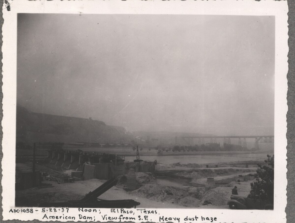
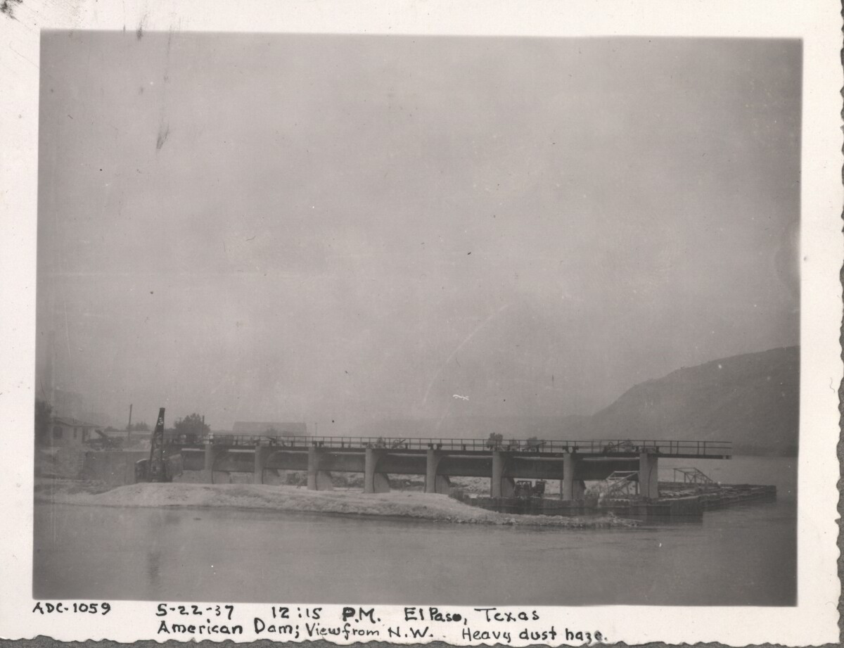
Note: 5-22-37 Noon; El Paso, Texas. American Dam; View from S.E. Heavy dust haze For centuries the Rio Grande River has been used as a source of irrigation water for agriculture in the El Paso – Juarez area. In 1889 the governments of the United States and Mexico established the International Boundary Commission (IBC), in 1944 renamed the International Boundary and Water Commission (IBWC). One of its early actions was to discuss delivery of Rio Grande water to Mexico. In 1906, the two countries agreed to deliver 60,000 acre-feet of water annually to Mexico at the main irrigation Canal in Ciudad Juarez, known as Acequia Madre. The canal's mouth is two miles downstream from the international border. The remainder of the water would be used by American farmers in the ninety-mile-long El Paso valley. In times of drought both Mexican and American shares would be reduced on a percentage basis. The system did not provide a way for the United States to allot Mexico its rightful portion and keep the rest. As a result, Mexico took its share first and channeled the remainder into the Franklin Canal for the farms in the El Paso valley. According to some American estimates this permitted Mexico to siphon off up to three times its portion of irrigation water. Responding in 1935, Congress authorized two diversionary projects, the American Dam and the American Canal. The dam caught the water in New Mexico short of the international border, measured Mexico's share and allowed it to continue to the Acequia Madre, and diverted everything else into the American Canal, a two-mile feeder leading to the Franklin Canal. The American Canal parallels West Paisano Drive (US Highway 85) and the Burlington Northern Santa Fe Railroad track. The project has proved a successful solution to the problem of dividing the waters. Sources: http://www.tshaonline.org/handbook/online/articles/rua03 http://www.ibwc.gov/Files/EnvironmentalAssessment.pdf
Area: Central / Smeltertown
Source: IBWC
Uploaded by: El Paso Museum of History
Construction of American Dam, 1937
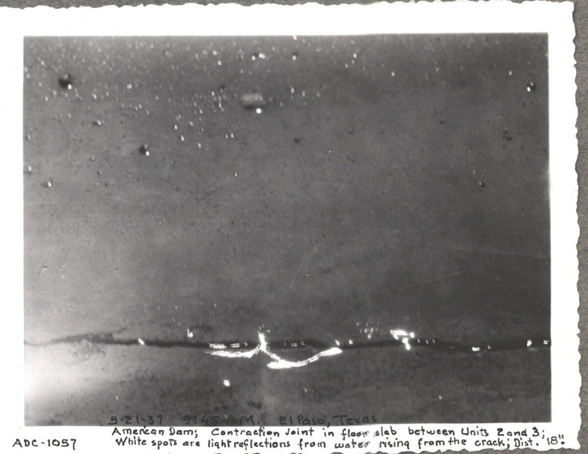
Note: American Dam; Contraction Joint in floor slab between Units 2 and 3; White spots are light reflections from water rising from the crack; Dist. 18". For centuries the Rio Grande River has been used as a source of irrigation water for agriculture in the El Paso – Juarez area. In 1889 the governments of the United States and Mexico established the International Boundary Commission (IBC), in 1944 renamed the International Boundary and Water Commission (IBWC). One of its early actions was to discuss delivery of Rio Grande water to Mexico. In 1906, the two countries agreed to deliver 60,000 acre-feet of water annually to Mexico at the main irrigation Canal in Ciudad Juarez, known as Acequia Madre. The canal's mouth is two miles downstream from the international border. The remainder of the water would be used by American farmers in the ninety-mile-long El Paso valley. In times of drought both Mexican and American shares would be reduced on a percentage basis. The system did not provide a way for the United States to allot Mexico its rightful portion and keep the rest. As a result, Mexico took its share first and channeled the remainder into the Franklin Canal for the farms in the El Paso valley. According to some American estimates this permitted Mexico to siphon off up to three times its portion of irrigation water. Responding in 1935, Congress authorized two diversionary projects, the American Dam and the American Canal. The dam caught the water in New Mexico short of the international border, measured Mexico's share and allowed it to continue to the Acequia Madre, and diverted everything else into the American Canal, a two-mile feeder leading to the Franklin Canal. The American Canal parallels West Paisano Drive (US Highway 85) and the Burlington Northern Santa Fe Railroad track. The project has proved a successful solution to the problem of dividing the waters. Sources: http://www.tshaonline.org/handbook/online/articles/rua03 http://www.ibwc.gov/Files/EnvironmentalAssessment.pdf
Area: Central / Smeltertown
Source: IBWC
Uploaded by: El Paso Museum of History
Construction of American Dam 1937
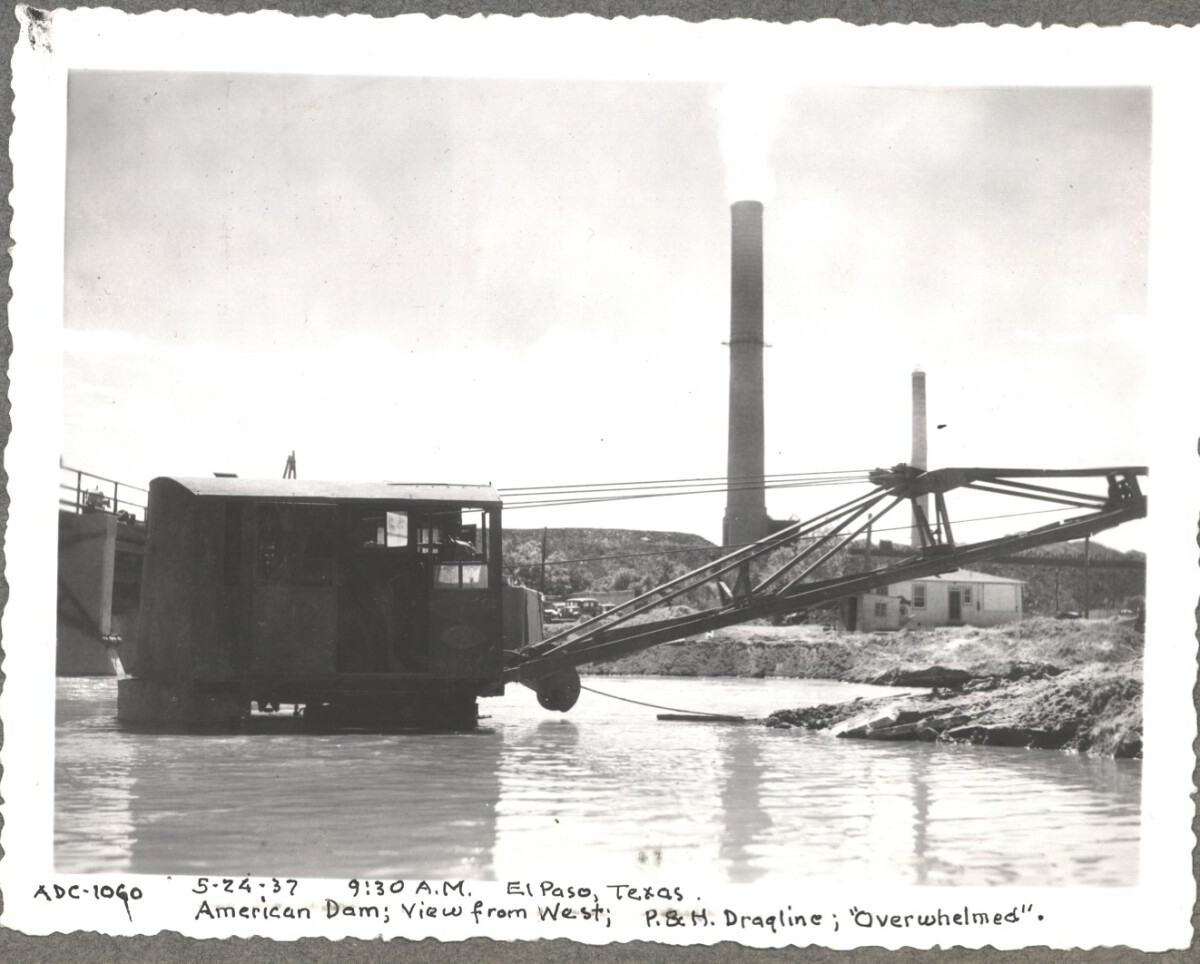
Note in image: 5-24-37, 9:30 am, El Paso, Texas. American Dam; View from West; P.&H. Dragline; "Overwhelmed". For centuries the Rio Grande River has been used as a source of irrigation water for agriculture in the El Paso – Juarez area. In 1889 the governments of the United States and Mexico established the International Boundary Commission (IBC), in 1944 renamed the International Boundary and Water Commission (IBWC). One of its early actions was to discuss delivery of Rio Grande water to Mexico. In 1906, the two countries agreed to deliver 60,000 acre-feet of water annually to Mexico at the main irrigation Canal in Ciudad Juarez, known as Acequia Madre. The canal's mouth is two miles downstream from the international border. The remainder of the water would be used by American farmers in the ninety-mile-long El Paso valley. In times of drought both Mexican and American shares would be reduced on a percentage basis. The system did not provide a way for the United States to allot Mexico its rightful portion and keep the rest. As a result, Mexico took its share first and channeled the remainder into the Franklin Canal for the farms in the El Paso valley. According to some American estimates this permitted Mexico to siphon off up to three times its portion of irrigation water. Responding in 1935, Congress authorized two diversionary projects, the American Dam and the American Canal. The dam caught the water in New Mexico short of the international border, measured Mexico's share and allowed it to continue to the Acequia Madre, and diverted everything else into the American Canal, a two-mile feeder leading to the Franklin Canal. The American Canal parallels West Paisano Drive (US Highway 85) and the Burlington Northern Santa Fe Railroad track. The project has proved a successful solution to the problem of dividing the waters. Sources: http://www.tshaonline.org/handbook/online/articles/rua03 http://www.ibwc.gov/Files/EnvironmentalAssessment.pdf
Area: Central / Smeltertown
Source: IBWC
Uploaded by: El Paso Museum of History
Construction of American Dam 1937
Note: 5-22-37, 12:15 pm, El Paso, Texas. American Dam; View from N.W. Heavy dust haze For centuries the Rio Grande River has been used as a source of irrigation water for agriculture in the El Paso – Juarez area. In 1889 the governments of the United States and Mexico established the International Boundary Commission (IBC), in 1944 renamed the International Boundary and Water Commission (IBWC). One of its early actions was to discuss delivery of Rio Grande water to Mexico. In 1906, the two countries agreed to deliver 60,000 acre-feet of water annually to Mexico at the main irrigation Canal in Ciudad Juarez, known as Acequia Madre. The canal's mouth is two miles downstream from the international border. The remainder of the water would be used by American farmers in the ninety-mile-long El Paso valley. In times of drought both Mexican and American shares would be reduced on a percentage basis. The system did not provide a way for the United States to allot Mexico its rightful portion and keep the rest. As a result, Mexico took its share first and channeled the remainder into the Franklin Canal for the farms in the El Paso valley. According to some American estimates this permitted Mexico to siphon off up to three times its portion of irrigation water. Responding in 1935, Congress authorized two diversionary projects, the American Dam and the American Canal. The dam caught the water in New Mexico short of the international border, measured Mexico's share and allowed it to continue to the Acequia Madre, and diverted everything else into the American Canal, a two-mile feeder leading to the Franklin Canal. The American Canal parallels West Paisano Drive (US Highway 85) and the Burlington Northern Santa Fe Railroad track. The project has proved a successful solution to the problem of dividing the waters. Sources: http://www.tshaonline.org/handbook/online/articles/rua03 http://www.ibwc.gov/Files/EnvironmentalAssessment.pdf
Area: Central / Smeltertown
Source: IBWC
Uploaded by: El Paso Museum of History
Construction of American Dam 1937
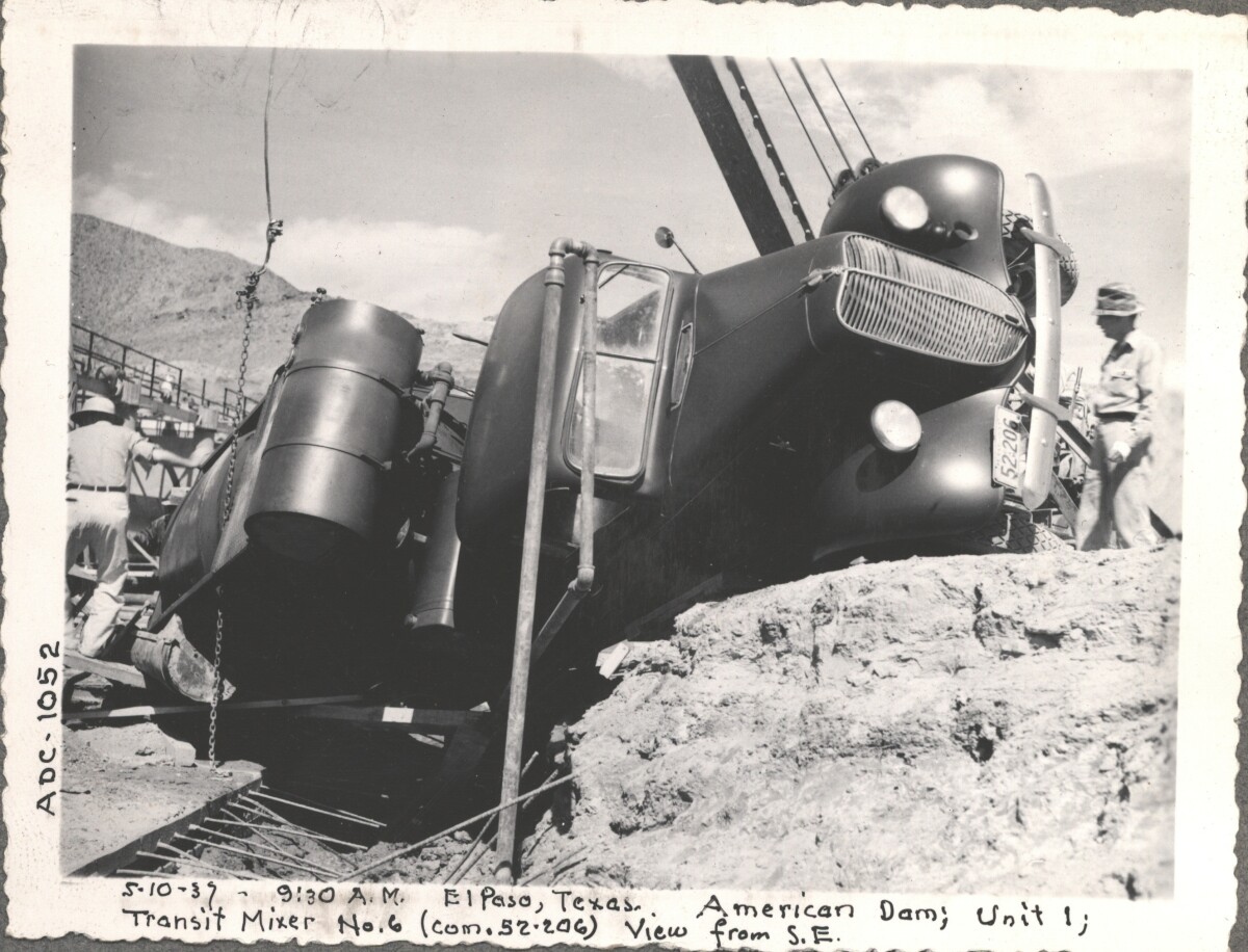
Note in image: 5-10-37, 9:30 am, El Paso, Texas American Dam; Unit I; Transit Mixer No. 6 (com. 52-206); View from S.E. For centuries the Rio Grande River has been used as a source of irrigation water for agriculture in the El Paso – Juarez area. In 1889 the governments of the United States and Mexico established the International Boundary Commission (IBC), in 1944 renamed the International Boundary and Water Commission (IBWC). One of its early actions was to discuss delivery of Rio Grande water to Mexico. In 1906, the two countries agreed to deliver 60,000 acre-feet of water annually to Mexico at the main irrigation Canal in Ciudad Juarez, known as Acequia Madre. The canal's mouth is two miles downstream from the international border. The remainder of the water would be used by American farmers in the ninety-mile-long El Paso valley. In times of drought both Mexican and American shares would be reduced on a percentage basis. The system did not provide a way for the United States to allot Mexico its rightful portion and keep the rest. As a result, Mexico took its share first and channeled the remainder into the Franklin Canal for the farms in the El Paso valley. According to some American estimates this permitted Mexico to siphon off up to three times its portion of irrigation water. Responding in 1935, Congress authorized two diversionary projects, the American Dam and the American Canal. The dam caught the water in New Mexico short of the international border, measured Mexico's share and allowed it to continue to the Acequia Madre, and diverted everything else into the American Canal, a two-mile feeder leading to the Franklin Canal. The American Canal parallels West Paisano Drive (US Highway 85) and the Burlington Northern Santa Fe Railroad track. The project has proved a successful solution to the problem of dividing the waters. Sources: http://www.tshaonline.org/handbook/online/articles/rua03 http://www.ibwc.gov/Files/EnvironmentalAssessment.pdf
Area: Central / Smeltertown
Source: IBWC
Uploaded by: El Paso Museum of History
American Dam 1937
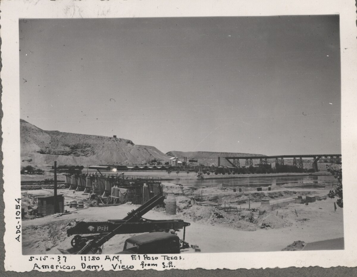
Note: 5-15-37, 11:50 am, El Paso, Texas American Dam; View from S.E. For centuries the Rio Grande River has been used as a source of irrigation water for agriculture in the El Paso – Juarez area. In 1889 the governments of the United States and Mexico established the International Boundary Commission (IBC), in 1944 renamed the International Boundary and Water Commission (IBWC). One of its early actions was to discuss delivery of Rio Grande water to Mexico. In 1906, the two countries agreed to deliver 60,000 acre-feet of water annually to Mexico at the main irrigation Canal in Ciudad Juarez, known as Acequia Madre. The canal's mouth is two miles downstream from the international border. The remainder of the water would be used by American farmers in the ninety-mile-long El Paso valley. In times of drought both Mexican and American shares would be reduced on a percentage basis. The system did not provide a way for the United States to allot Mexico its rightful portion and keep the rest. As a result, Mexico took its share first and channeled the remainder into the Franklin Canal for the farms in the El Paso valley. According to some American estimates this permitted Mexico to siphon off up to three times its portion of irrigation water. Responding in 1935, Congress authorized two diversionary projects, the American Dam and the American Canal. The dam caught the water in New Mexico short of the international border, measured Mexico's share and allowed it to continue to the Acequia Madre, and diverted everything else into the American Canal, a two-mile feeder leading to the Franklin Canal. The American Canal parallels West Paisano Drive (US Highway 85) and the Burlington Northern Santa Fe Railroad track. The project has proved a successful solution to the problem of dividing the waters. Sources: http://www.tshaonline.org/handbook/online/articles/rua03 http://www.ibwc.gov/Files/EnvironmentalAssessment.pdf
Area: Central / Smeltertown
Source: IBWC
Uploaded by: El Paso Museum of History
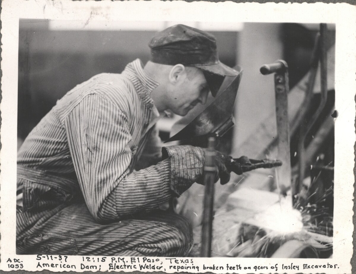
Electric Welder at American Dam, 1937
Note in image: 5-11-37, 12:15 pm, El Paso, Texas American Dam; Electric Welder, repairing broken teeth on gears of Insley Excavator For centuries the Rio Grande River has been used as a source of irrigation water for agriculture in the El Paso – Juarez area. In 1889 the governments of the United States and Mexico established the International Boundary Commission (IBC), in 1944 renamed the International Boundary and Water Commission (IBWC). One of its early actions was to discuss delivery of Rio Grande water to Mexico. In 1906, the two countries agreed to deliver 60,000 acre-feet of water annually to Mexico at the main irrigation Canal in Ciudad Juarez, known as Acequia Madre. The canal's mouth is two miles downstream from the international border. The remainder of the water would be used by American farmers in the ninety-mile-long El Paso valley. In times of drought both Mexican and American shares would be reduced on a percentage basis. The system did not provide a way for the United States to allot Mexico its rightful portion and keep the rest. As a result, Mexico took its share first and channeled the remainder into the Franklin Canal for the farms in the El Paso valley. According to some American estimates this permitted Mexico to siphon off up to three times its portion of irrigation water. Responding in 1935, Congress authorized two diversionary projects, the American Dam and the American Canal. The dam caught the water in New Mexico short of the international border, measured Mexico's share and allowed it to continue to the Acequia Madre, and diverted everything else into the American Canal, a two-mile feeder leading to the Franklin Canal. The American Canal parallels West Paisano Drive (US Highway 85) and the Burlington Northern Santa Fe Railroad track. The project has proved a successful solution to the problem of dividing the waters. Sources: http://www.tshaonline.org/handbook/online/articles/rua03 http://www.ibwc.gov/Files/EnvironmentalAssessment.pdf
Area: Central / Smeltertown
Source: IBWC
Uploaded by: El Paso Museum of History
American Dam 1937
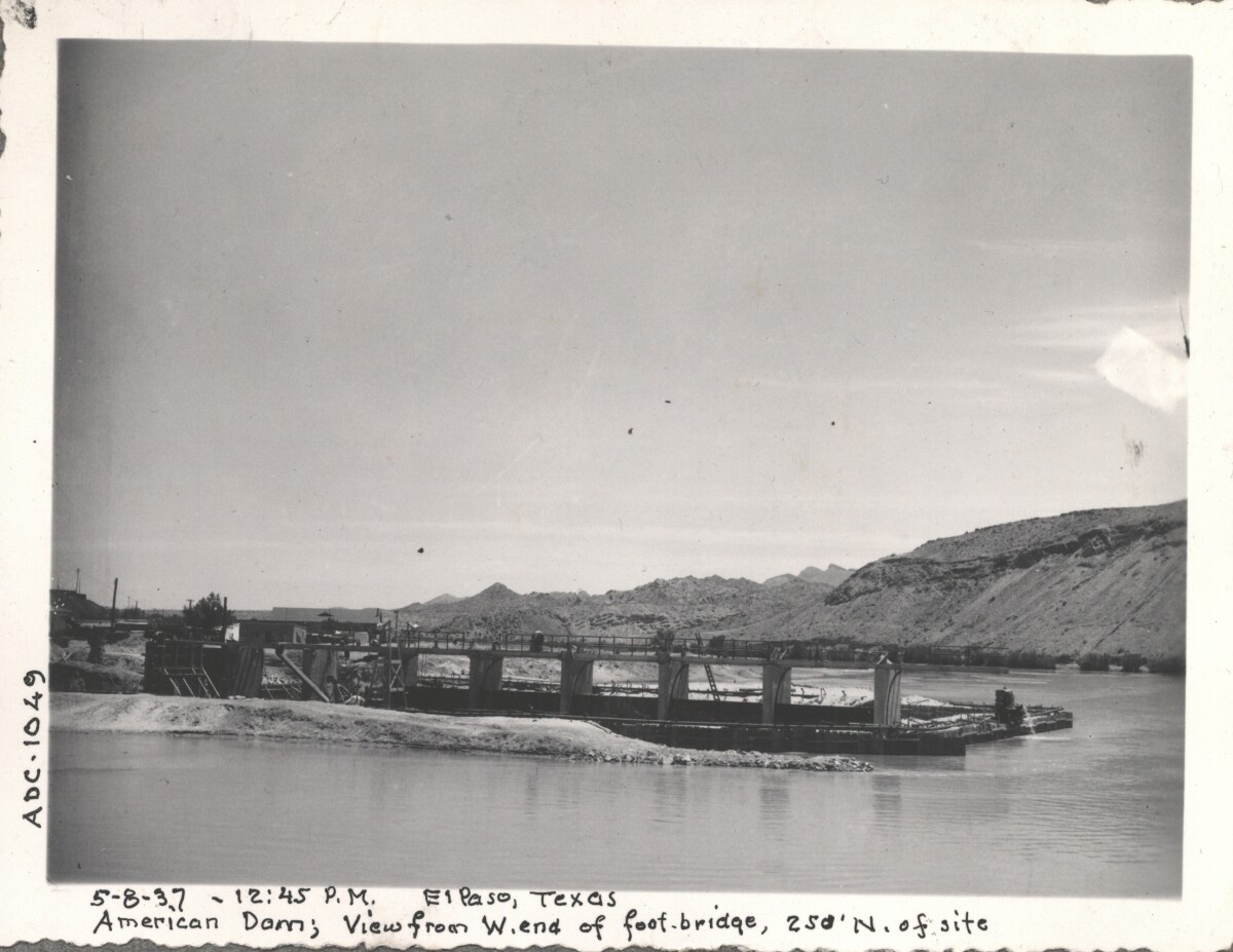
Note under image: 5-8-37, 12:45 pm, El Paso, Texas American Dam; View from W.end of foot-bridge, 250' N. of site For centuries the Rio Grande River has been used as a source of irrigation water for agriculture in the El Paso – Juarez area. In 1889 the governments of the United States and Mexico established the International Boundary Commission (IBC), in 1944 renamed the International Boundary and Water Commission (IBWC). One of its early actions was to discuss delivery of Rio Grande water to Mexico. In 1906, the two countries agreed to deliver 60,000 acre-feet of water annually to Mexico at the main irrigation Canal in Ciudad Juarez, known as Acequia Madre. The canal's mouth is two miles downstream from the international border. The remainder of the water would be used by American farmers in the ninety-mile-long El Paso valley. In times of drought both Mexican and American shares would be reduced on a percentage basis. The system did not provide a way for the United States to allot Mexico its rightful portion and keep the rest. As a result, Mexico took its share first and channeled the remainder into the Franklin Canal for the farms in the El Paso valley. According to some American estimates this permitted Mexico to siphon off up to three times its portion of irrigation water. Responding in 1935, Congress authorized two diversionary projects, the American Dam and the American Canal. The dam caught the water in New Mexico short of the international border, measured Mexico's share and allowed it to continue to the Acequia Madre, and diverted everything else into the American Canal, a two-mile feeder leading to the Franklin Canal. The American Canal parallels West Paisano Drive (US Highway 85) and the Burlington Northern Santa Fe Railroad track. The project has proved a successful solution to the problem of dividing the waters. Sources: http://www.tshaonline.org/handbook/online/articles/rua03 http://www.ibwc.gov/Files/EnvironmentalAssessment.pdf
Area: Central / Smeltertown
Source: IBWC
Uploaded by: El Paso Museum of History
Construction of American Canal, 1937
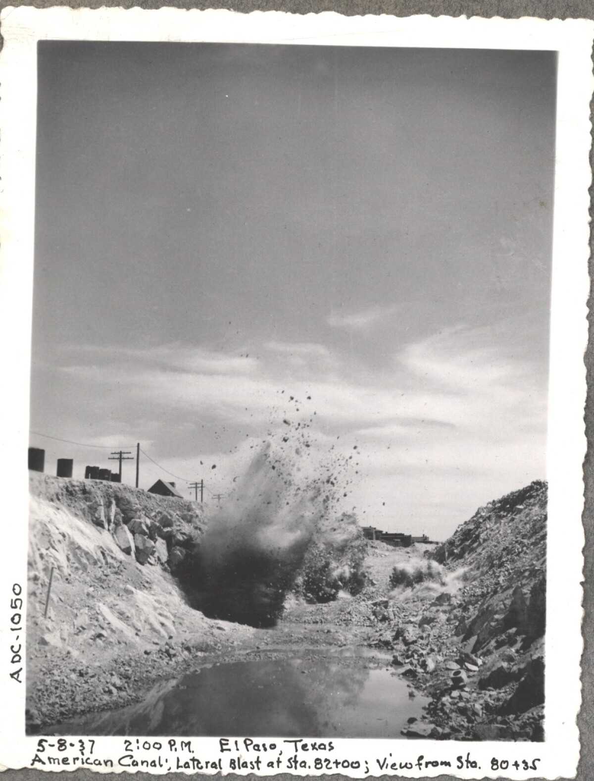
Note under image: 5-8-37, 2:00 pm, El Paso, Texas American Canal; Latcral Blast at Sta. 82+00; View from Sta. 80+35 For centuries the Rio Grande River has been used as a source of irrigation water for agriculture in the El Paso – Juarez area. In 1889 the governments of the United States and Mexico established the International Boundary Commission (IBC), in 1944 renamed the International Boundary and Water Commission (IBWC). One of its early actions was to discuss delivery of Rio Grande water to Mexico. In 1906, the two countries agreed to deliver 60,000 acre-feet of water annually to Mexico at the main irrigation Canal in Ciudad Juarez, known as Acequia Madre. The canal's mouth is two miles downstream from the international border. The remainder of the water would be used by American farmers in the ninety-mile-long El Paso valley. In times of drought both Mexican and American shares would be reduced on a percentage basis. The system did not provide a way for the United States to allot Mexico its rightful portion and keep the rest. As a result, Mexico took its share first and channeled the remainder into the Franklin Canal for the farms in the El Paso valley. According to some American estimates this permitted Mexico to siphon off up to three times its portion of irrigation water. Responding in 1935, Congress authorized two diversionary projects, the American Dam and the American Canal. The dam caught the water in New Mexico short of the international border, measured Mexico's share and allowed it to continue to the Acequia Madre, and diverted everything else into the American Canal, a two-mile feeder leading to the Franklin Canal. The American Canal parallels West Paisano Drive (US Highway 85) and the Burlington Northern Santa Fe Railroad track. The project has proved a successful solution to the problem of dividing the waters. Sources: http://www.tshaonline.org/handbook/online/articles/rua03 http://www.ibwc.gov/Files/EnvironmentalAssessment.pdf
Area: Central / Smeltertown
Source: IBWC
Uploaded by: El Paso Museum of History
American Dam
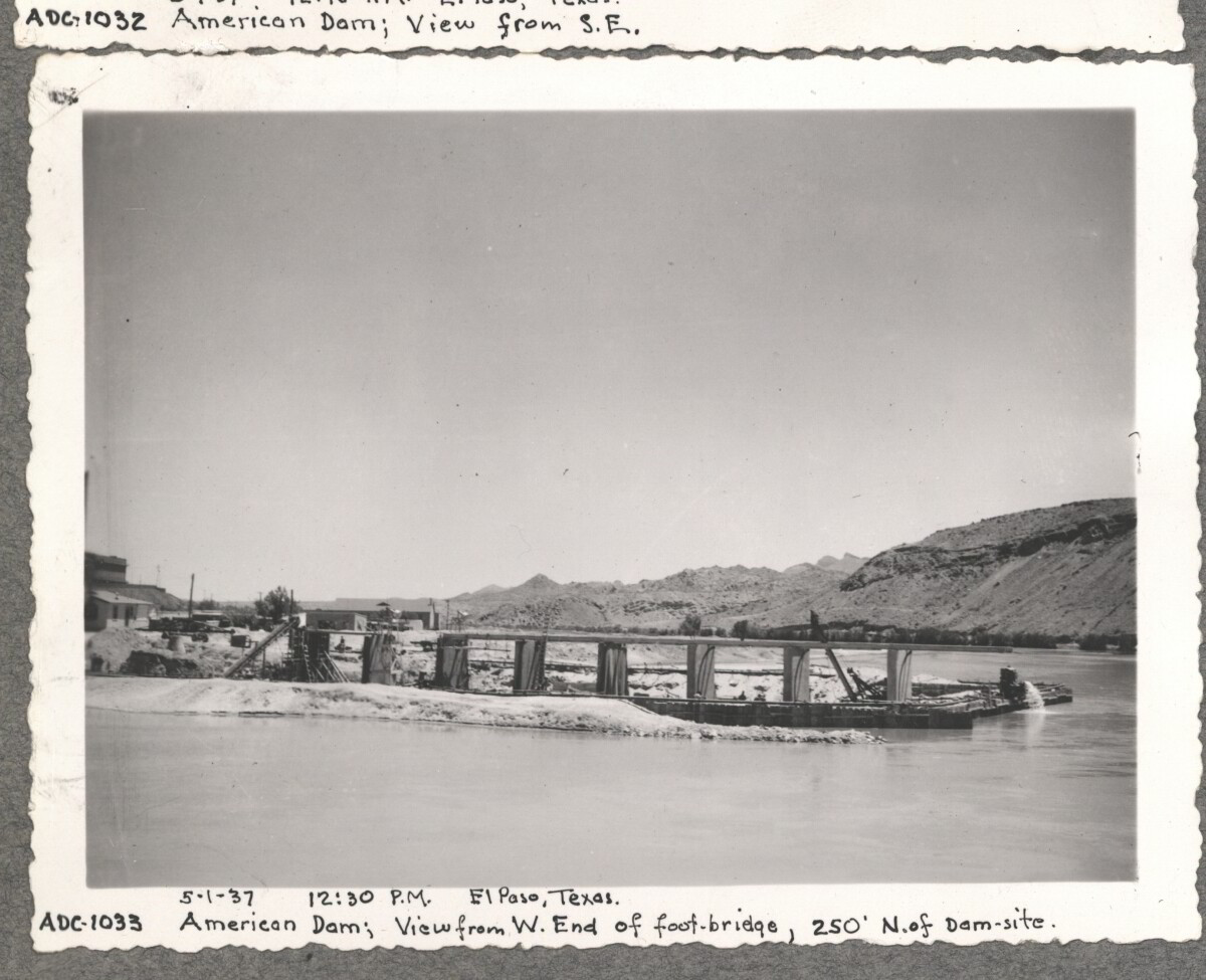
May 1, 1937 12:30 PM El paso TX. American Dam, view from West end of foot bridge 250' north of dam.
Area: Central / Smeltertown
Source: IBWC
Uploaded by: El Paso Museum of History
American Dam
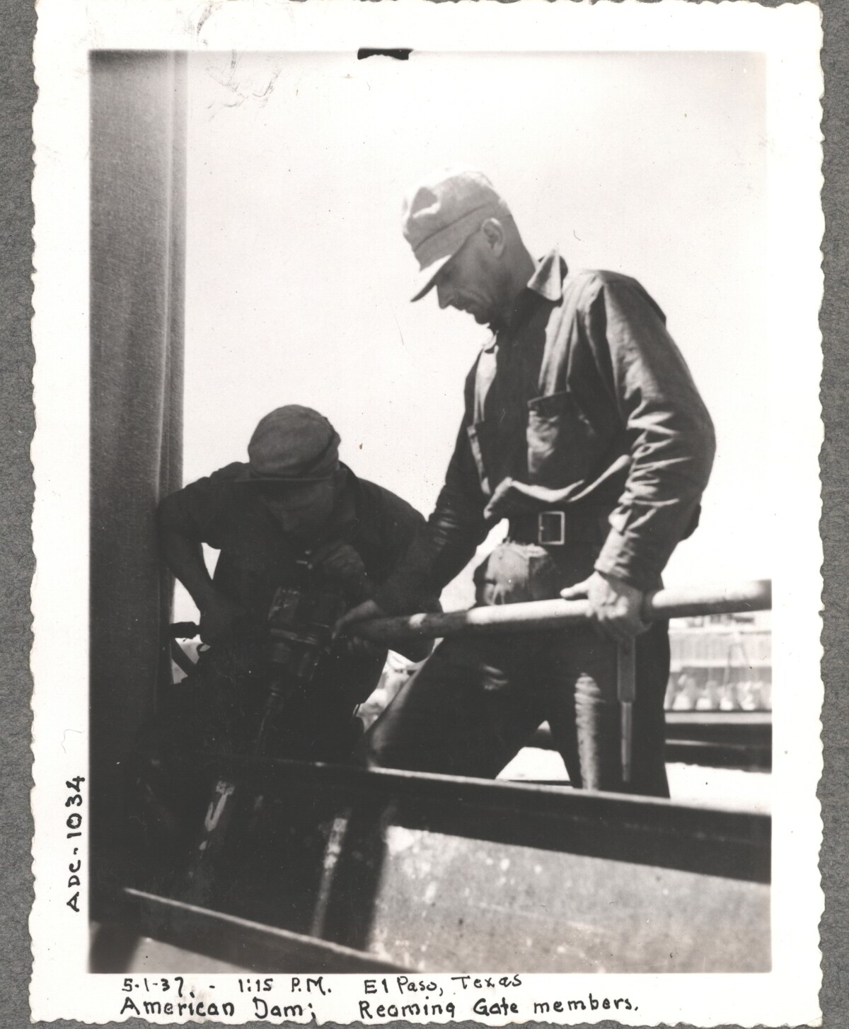
May 1.1937 1:25 PM El Paso TX. American Dam, reaming gate members.
Area: Central / Smeltertown
Source: IBWC
Uploaded by: El Paso Museum of History
American Dam
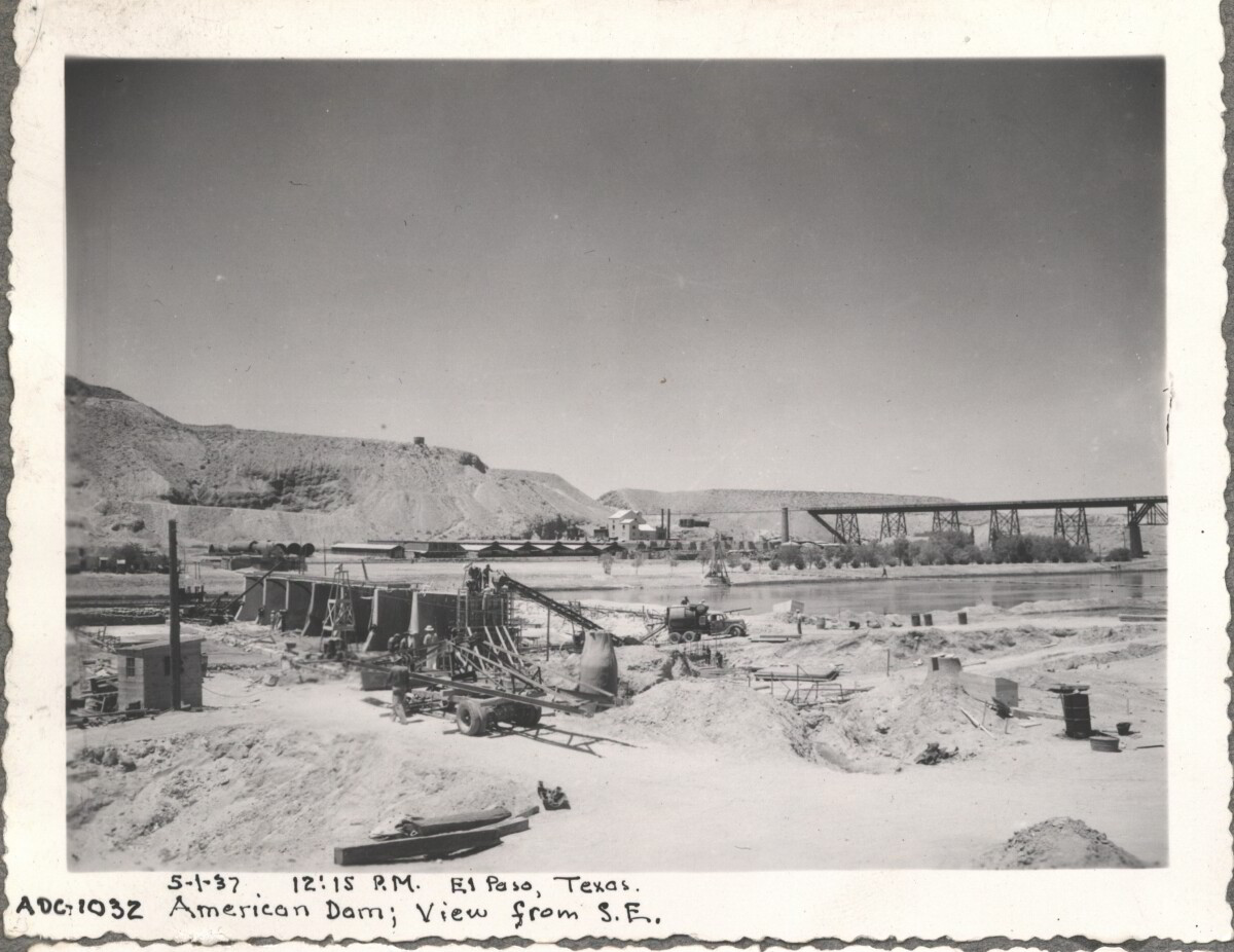
May 1, 1937 12:15 PM El paso TX. American Dam, view from southeast.
Area: Central / Smeltertown
Source: IBWC
Uploaded by: El Paso Museum of History
American Dam
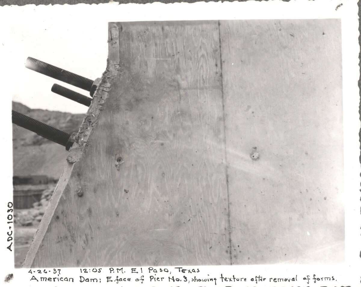
April 24, 1937 1:00 PM El Paso TX. American Dam east face of pier No. 3 showing texture after removing forms.
Area: Central / Smeltertown
Source: IBWC
Uploaded by: El Paso Museum of History
American Dam
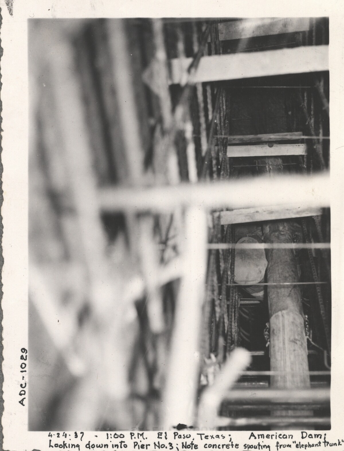
April 24, 1937 1:00 PM El Paso TX. American Dam looking down into pier No. 3 concrete spouting from elephant trunk.
Area: Central / Smeltertown
Source: IBWC
Uploaded by: El Paso Museum of History
American Dam
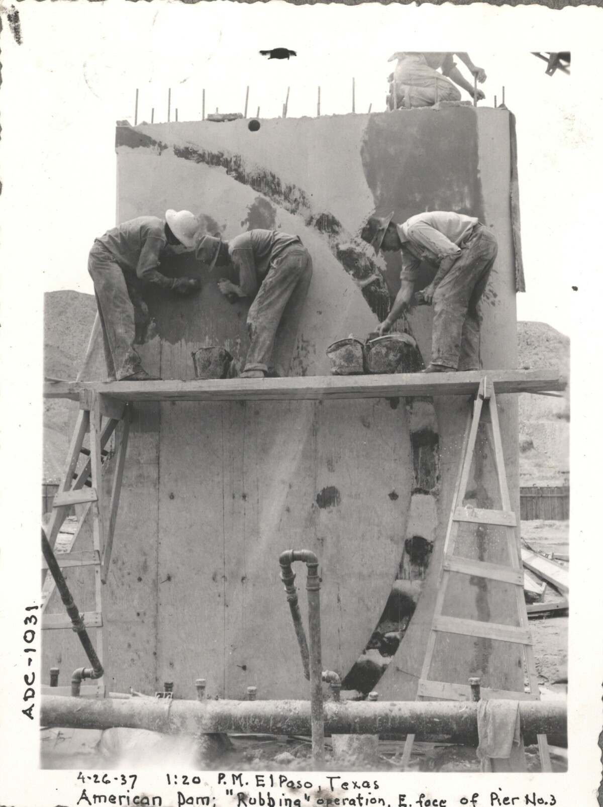
April 26, 1937 1:20 PM El Paso TX. American Dam, rubbing operations east face of pier No. 3.
Area: Central / Smeltertown
Source: IBWC
Uploaded by: El Paso Museum of History
Report this entry
More from the same community-collection
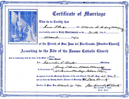
Marriage License Luis Flores and Maria de la Luz Marquez
Marriage license from my grandparents wedding on March 31, 1940.
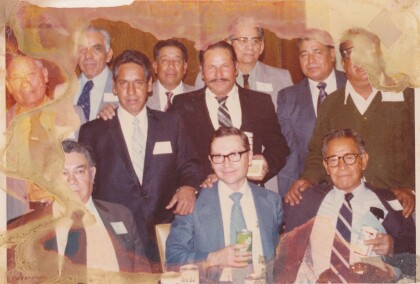
Asarco - El Paso, Texas - 1960's
This is a picture of ASARCO men that worked there and some lived ...
Comments
Add a comment